Selected Logs from Roldanillo, Colombia 2025-02
2025-02-28
 On the last day of our trip, the mythic Colombia 100km FAI triangle had so far eluded Tom, Kirby, Alex, Barry and I. Our trip had intersected with much damper conditions than we were expecting; Mornings were spent waiting until 11 or 12 for the clouds to rise and hoping that we could get away from the hills. Afternoons were marked with consistent overdevelopment; thunderstorms and rain had shown up nearly every day. The only benefit was that El Pacifico had been uncharacteristically weak, allowing us to get close back to Roldanillo on most days.
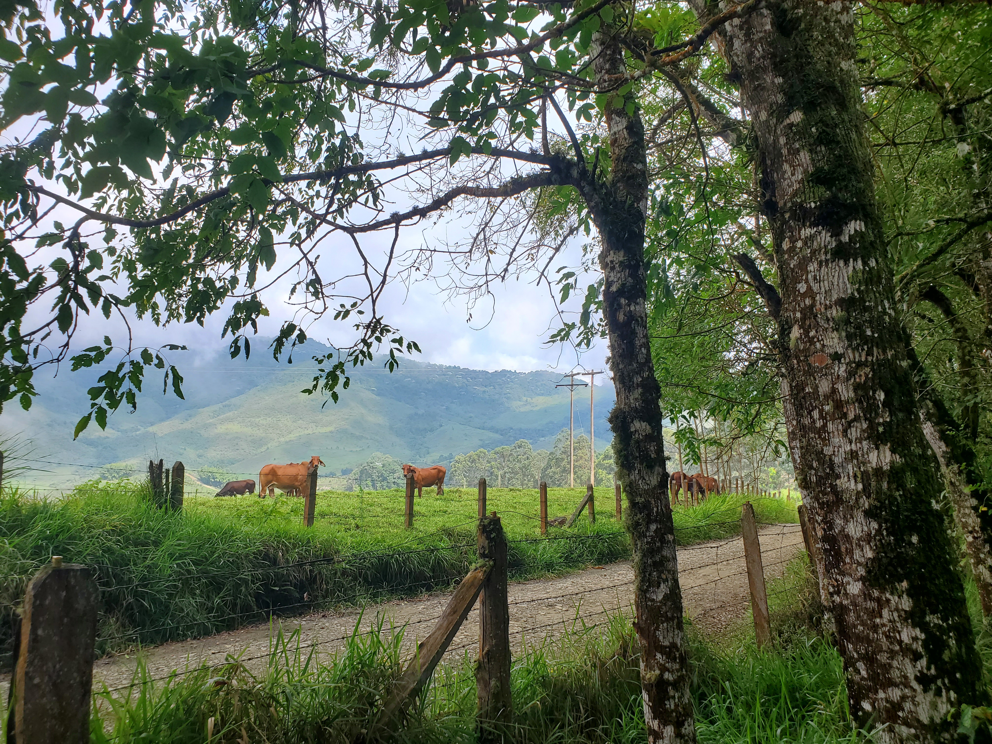
Tom and I made our way up to Aguapanela, where we were greeted by a group of cows, In the mid-morning, we launched with blind high hopes. Forecasting in Colombia is simple: one shows up to launch, and expects the day to work well. There is no real way to tell ahead of time how a day will turn out.
The first leg of my flight followed the same pattern as most of my flights from earlier in the week- I headed north. We were able to launch earlier than normal, but it was a slow start to the day. Almost immediately, Tom bombed 10km north of launch, still close enough to the town of Roldanillo to walk back. I pushed on alone. I made the crossing over the town of La Union, then followed a pilot on a submarine and Gin Boomerang 12 out on a deep line behind Toro. Cloud base was low, and when I got to San Fransisco, I flew as close as I dared to the bottom before tagging the northern ridge and turning back south.
Working my way south, the wind began to blow from the southwest. In a climb over La Union again, I was drifting enough with the wind that I decided I didn’t want to be near the mountains anymore. I followed a line of clouds out to the valley, following them to the east of Zarzal.
It was 2:30pm by now, and the skies didn’t show the same signs of OD as other days. Instead, cloud base was lifting higher and higher. To the east of Zarzal, I was at a decision point- with the good conditions, could I push out my flight farther to the east? The clouds were working well, but the wind was getting stronger form the west. It would be easy pushing farther from home, but difficult to make it back. I found a strong climb to 2500m, and committed to pushing east.
I took an easy downwind glide out to the top of the range south of Corozal. My “Unfinished FAI triangle” indicator on my instrument read 110km. I had the opportunity to close the largest triangle I had every flown, but the remaining portion of the flight would be the hardest.
I nearly bombed out on the ridge. I arrived low and scratched to find a climb. I was guided by a group of birds, who first showed me a climb enough to stay alive, then guided me to a strong, tall climb that took my mind away from the challenge of not landing, and back to the challenge of making it back.
I pushed full bar upwind from cloud to cloud. I felty like I had won the lottery each time I found the climb underneath. Base had lifted to 2700m, and I scraped the bottom of each cloud before pushing back on glide upwind. At one point, I left a climb too late, and was pulled up into the bottom of the cloud on glide to the west. I was fully engulfed in white, but kept my bearing with my compass and flight instrument.
 After a harrowing 30 seconds of cloud cover, the white room around me got brighter and brighter, taking on a golden hue. I flew out the side of the cloud directly towards the light from the mid-afternoon glow of the sun.
Eventually the headwind got the best of me, and I found a huge field alongside the main road to land in. I came in straight down on half bar, and set the glider down gently. My instrument read 101km FAI triangle. I packed up and walked back to our apartment, a huge grin on my face.
Click and drag to pan. Scroll to zoom. Control + click and drag to rotate